
At the time of the first European settlement, the Nabiac district was inhabited by the Katang-speaking aboriginal people of the Worimi and Biripai tribes.
Lieutenant James Cook, RN observed smoke from cooking fires and documented the presence of Aboriginal people on the coastal strip as his ship the Endeavour sailed north on Thursday, 10 and Friday, 11 May 1770. Cook also named three localities in the district – Port Stephens, Cape Hawke (present day Forster) and the Three Brothers (mountain features just to the north of Taree) – as he passed. Commander Matthew Flinders, RN also sailed this section of the coast on three separate occasions – 9 July 1799, 23 July 1802 and 12 August 1803 – and his charts (that were published in the year of his death in 1814) show mountain ridges inland from Cape Hawke and it is possible Mt. Talawahl was one of those included.
It is fair to say the first Europeans to visit this area arrived by misadventure in that they landed as the result of ships founding off the coast but from about 1816, cedar cutters (mostly assigned convicts) moved into the waterways to extract the timber. Lieutenant John Oxley, RN led, what is considered to be the first organised land exploration of this district, with an expedition that came down the coast from Port Macquarie in 1818. The group crossed the mouth of what was later to become Wallis Lake on 25 October 1818 in a four metre row boat – from the Jane, one of the vessels that had founded earlier on our section of the coast and which they had discovered earlier half buried on a beach.
Maps published in the late 1820s showed Wallis Lake and not only the several rivers flowing into it but also indicated where the heads of navigation were located so it appears by this time, vessels had not only entered the lake but had journeyed beyond the present site of Nabiac.
In 1824 the Australian Agricultural Company (AAC) was formed in England with the view of procuring a million acres of land for as many pounds. The grant covered the area from the Manning River south to Port Stephens and its western boundary was a line from the Manning just west of Gloucester, south to the Karuah River. It was intended this area – with the aid of convict labour – would be used for extensive pastoral and agricultural schemes. In 1826 Henry Dangar made a survey of the grant, published a map showing the results of his work in 1828 and it is thought he also named the rivers in the Lake Wallis area. It also appears a falling out Dangar had with Governor Darling cast doubt on his work and as a result, on 2 June 1830 Sir William Edward Parry (the Arctic explorer) left Stroud to examine the AAC‘s land grant again and report on its potential. Parry‘s manuscript diary is said to be a fine piece of work
and on Wednesday, 9 June 1830, he was close to the present day site of Nabiac. He described what he saw in the following terms:
As the country hereabouts appeared better than usual, the bullocks rested for the day, while Messrs. Armstrong and Hall and myself rode about to examine the land. At one mile east, saw the hill named “Tallowah” by the blacks, N 23 deg. E 5 or 6 miles distant. East two miles, the whole being second-rate forest thickly timbered, with much oak, pleasant looking enough, but not good grass – the hills gentle and low. Here (i.e. 3 miles east of the tents) came into Mr. Dangar’s homeward marked – tree road. Again two miles east over oak-scrub, very poor, with some swamp in sight occasionally. Again half a mile east, through oak-scrub to a very expansive open swamp (two emus) which was evidently bordering the Wollumba River tho’ we could not see it for the high reeds. From hence Cape Hawke 113 deg.45’… Then went SW b. S ½ mile principally swamp – Tallowah N 21 deg. W, in this view conical, and the range of which it is the South-Eastern end, shut in behind it. SW b. S 1½ mile thro’ 2nd class forest, very thickly timbered, none of it fit for sheep.
Parry‘s report was instrumental in the company’s decision to condemn much of the grant, especially the coastal section, as it was quite unfit for sheep and other pursuits favoured by the company’s shareholders. In time the company was able to exchange most of their original grant for an area in the Liverpool plains region and the coastal strip again became Crown land.
During the earliest days of the colony, the government did not encourage widespread settlement but by 1826, they had declared Cape Hawke as the northernmost limit to which settlers could proceed. The limit was extended to the Manning in 1829 and the following year to Port Macquarie. By the 1830s timber cutters were granted licences to cut cedar and build huts but they were not permitted to cultivate the land.
The first land grant on the Wallamba was at Nabiac and it covered an area of 115 acres (some 47 hectares). It was purchased by a Henry Carmichael at a sale in Dungog in July 1855 and the plot was on the north side of the river, just to the west of the present highway bridge across the Wallamba. Additional blocks were offered for sale at Dungog on 22 September 1857, but no bids were made for them. William Henry Ralston McClymont who was the stepson of Henry Carmichael (Henry married the mother after William’s father died at the Ship Inn at Newcastle at the age of 29, when William was an infant) did however; select two blocks later that year. The first (of 84 acres) adjoined Carmichael‘s block while the second (of 55 acres) was to the west of the present highway and included the area where the new roundabout is located. No further land grants on the Wallamba seem to have been made until after Sir John Robertson‘s Act of 1861 which permitted free selection before survey. Under this Act, selectors could choose an area of 40 to 320 acres at £1 per acre on conditional purchase, and pay ¼ of the purchase price as a deposit. Selectors were then required to stay 3 years, make improvements worth £1 per acre and pay off the balance at 5% virtually at will. With this change in policy, more settlers began to arrive and the development of the area moved forward on a number of fronts:
Transport
In the earliest of times, the only roads were tracks which followed lines of marked trees through the bush. By 1840 the AAC settlements of Booral, Gloucester and Stroud were joined to each other and to Raymond Terrace by a well-defined road. The fact that the coastal road was slow in development was probably due to brisk shipping activity along the coast. By 1857 the main northern road had been extended from Gloucester to Kempsey and Port Macquarie. The NSW Gazetteer and Road Guide published in 1866 shows a main road from Stroud through Bulahdelah, Firefly Creek and Larry’s Flat (Krambach) to Tinonee. Another road is shown from the Wang Wauk River to Tinonee, crossing the Wallamba and passing through Kooringhat (later to be known as Sidebottom and still later, Rainbow Flat). No direct link is shown between Bulahdelah and the Wang Wauk River though as late as 1900, travellers on this coastal route carried axes to aid their passage along it. The road through Gloucester became in time, a portion of the Pacific Highway but this was altered on 22 August 1952 when the present alignment of the route through Nabiac, was proclaimed instead.
Land travel to and though the district was of course, very slow and in his Peeps into the Past, Mr F A Fitzpatrick quotes a letter written in 1881 by S Osborne who described his trip in a bullock dray from Raymond Terrace to the Manning:
I started on the 9th April, 1844, with a dray and two pairs of bullocks, my companions being a man and his wife and two children; we were ten days on our journey. The first night we had to sleep in the bush; the second at a place called The Boorell; the third at Tiligary; the fourth at Haven Creek; the fifth at a place called Talagarra, the sixth, seventh and eighth in the bush, the ninth at Bundy Creek and the tenth in the bush.
On the eleventh day we reached our station. During the journey I saw no more that 100 acres of cultivation land. Most of the land was utilised as cattle and sheep stations, and most of them were owned by the Australian Coy. On the last 50 miles of the journey there was no road – merely a number of marked trees. So we were obliged to get a black to show us the way over the 50 miles, some of which was so bad that we had to cut trees down and tie them behind the cart and also tie the wheels, whilst going down some of the awful hills.
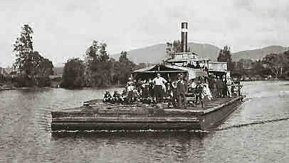
Photograph of the Dauntless and the caption on the rear of the shot relates “Off to Regatta – landing (at) McCann’s Wharf (Tuncurry)”
Courtesy of the late Les Weller’s collection.
As mentioned earlier, one of the reasons for the lack of development of a coastal road was probably due to brisk shipping activity and this dated back to the middle of the 19th century. Early vessels on the Wallamba were polling punts on which a sail was sometimes hoisted, if the conditions were favourable. It could also be expected that the movements of these vessels on the river would be timed to the ebb and flow of the tides. Log punts and droghers were terms that seemed to interchange to describe the introduction in the 1870s, of steam powered, paddle wheeled vessels. Many of these were built in Failford, Forster, Nabiac and Tuncurry and carried such names as: Dauntless (shown), King Edward, Nil Desperandum, Victory, Wallamba and Wheelbarrow. These vessels were the link between the coastal ships and settlers up river as they carried produce such as fitches of bacon, kegs of salted butter, maize, opossum skins, sawn timber, wooden roofing shingles (and anything else that would sell in Sydney) to Tuncurry for transhipment. On their return journeys up the river they carried manufactured goods that had been ordered in from distant locations such as Newcastle, Sydney or beyond.
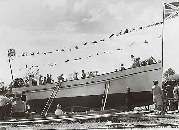
Launch of the Mororo II onto the Wallamba River.
Photography of the late Archie Blanch.
Courtesy of the late Les Weller’s collection.
One of the heaviest blows struck at coastal shipping was the opening of the railway to Taree in 1912. Until then, and indeed until the outbreak of World War II, local storekeepers and farmers received much of their provisions and equipment via the Wallamba and most agreed that the service by water left little room for improvement.
In time however, the district roads improved though a continuing problem with any road on the coastal strip was the almost never ending occurrence of ridges and rivers. The ridges meant winding roads of almost impossible gradients
– as described by S Osborne earlier – and the rivers meant the need for bridges or low level causeways. The latter were relatively inexpensive to construct but had the disadvantage of being almost impassable with even a slight rise in the water level.
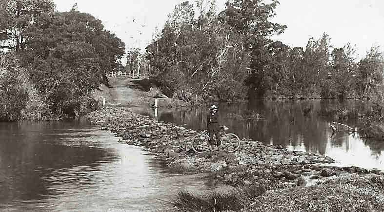
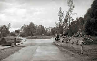
Photograph of Clarkson’s Crossing on the Wallamba River taken around 1914-15. The crossing separated salt water (left) from fresh water (right).
Courtesy of the late Les Weller’s collection.
Exactly when Nabiac’s causeway across the Wallamba River was constructed is not now known but it served two purposes: it provided a safe and firm bottomed means of crossing the river; and the roadway effectively set the limit of the tidal reaches of the Wallamba. It was located just to the south of Nabiac and it bore the name of Clarkson’s Crossing (shown) which was interesting as there was never any family in the district with that name. There had been an early pioneer settler named Clarkin who worked land near this site in 1862 but for reasons now lost, it appears the name of Clarkin was corrupted to Clarkson and that name stuck.
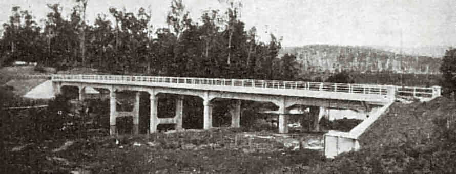
Postcard photograph of the Wang Wauk Bridge.
Courtesy of the late Les Weller’s collection.
Photograph of the accident at The (Clarkson’s) Crossing.
Courtesy of the late Les Weller’s collection.
lost the road, drifted wide, missed the first bridge and became another crash statistic for The Crossing and the Pacific Highway.
Wallamba Bridge opening day souvenir badge.
Courtesy of the late Les Weller’s collection.
In 1942 an aerodrome was constructed by the Public Works Department to the south east of Nabiac and it was accessed via Glen Ora Road. It consisted of four runways, two concrete bomb dumps, camouflaged hangers for the RAAF Anson and Boston aircraft stationed there as well as several slightly less camouflaged dummy hangers – complete with aircraft made from wooden battens and chicken wire – which were still evident through to the late 1950s. Folklore in the village had it that the Nabiac Aerodrome was the fall-back facility had the Japanese broken through at the Coral Sea. After the war the aerodrome was disused for a time until New England Airways commenced a passenger and freight service. Butler Airways then took over and used it until the Wallis Island Aerodrome at Forster opened in 1952. The Nabiac Aerodrome is now “owned” by the Central North Coast Sporting Car Club, Taree and they hold regular events on its gravel runways. The aerodrome also sits atop the Tomago Sands from which pure water has been drawn since the late 19thcentury when several coffer dams were constructed on the banks of the Wallamba River to enable the steam driven log punts/droghers to resupply their tanks with water that wouldn’t rust their boilers. Midcoast Water (the local water supply authority for the Great Lakes and Greater Taree Shires) has recently sunk a series of bores into the sands near the aerodrome and is expected shortly to begin extracting water to supplement their current supply obtained from conventional dams.
Post Office
In March 1869, some 38 settlers signed a partition requesting the establishment of a Post Office in the area and after a series of inspections, the establishment was approved and it was opened in May 1870, on a site described by an unknown writer as at a spot which can be identified by a clump of orange trees, situated to the back of the property adjacent to The Crossing and owned by Mr Wallis…
This would have been on the south side of the river, a little up stream from The Crossing. The Post Office however, was called the Cape Hawke Post Office but this caused some problems when in 1878, a local resident complained that a letter addressed to them at Cape Hawke had been wrongly forwarded. A name change was thought to be the best solution and “Wollomba” (the official name of the river) was suggested but this was rejected as it was thought to be too close in spelling to the already established “Wollombi” and so the name of “Clarkson’s Crossing” was adopted in February 1880. It should also be mentioned at this point that Mr Horace Dean MP thought it appropriate and suggested the Post Office should be named “Deanville”! The first Post Master was Charles G Smith, the teacher who had been appointed to the two half-time schools in the area. In March 1894 however, Hugh McKinnon MP wrote to the Department complaining that the name of “Clarkson’s Crossing” was a mistake as there had never been any family in the area named “Clarkson”. In an effort to clear up the trouble, McKinnon suggested the place be called “Burnside”, after the local estate owned by John Breckenridge. This suggestion was also scrapped however; as there was already a “Burnside” in South Australia and the Department contacted McKinnon again asking him for another name. McKinnon then came up with the aboriginal term “Nabyack” (his spelling) and when this was referred to the Lands Department, they accepted the name but with a spelling of “Nabiac”. The Nabiac Post Office came into being on 1 June 1894.

Photograph of Nabiac’s businesses.
Courtesy of the late Les Weller’s collection.
Over the next few years the actual location of the Post Office moved several times but has never very far from the centre of the village. In June 1899 James and Jane Bowers moved the Post Office (the building on the right of the double roofed building shown in the photograph) to the corner of Clarkson and Nabiac Streets. They added the second building in 1910. The other buildings in this photograph show (in the centre) the hotel and (on the right) the store built by Michael Marsh. It is presently occupied (2005) by Robb & Co. In May, 1945 the Nabiac Post Office was taken over by a Mr Wicks and he moved it to another building a hundred metres down Nabiac Street. In 2005 the operation was purchased by Malcolm O’Mara and he moved it into The Old Bank Centre.
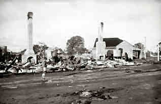
Aftermath of the Nabiac business fire.
Courtesy of the late Les Weller’s collection.
Schools
In 1866 Mr (later Sir) Henry Parkes successfully introduced the Public Schools Act in NSW. In essence it stated that where 25 pupils would attend regularly, public schools were to be established and the difficult problem of catering for the children of widely scattered settlers was to be met by provisional and half-time schools. Settlers along the river availed themselves of the Act and made application in 1868 for two half-time schools – one to be called Upper Wallamba and the other Lower Wallamba. The Council of Education approved the application and by March 1869 the schools were established having 54 pupils on the combined roll. It has been determined that the Lower school was located on what is now the Logan Lea property on Glen Ora Road to the south of Nabiac while the Upper was on the property just before the low level crossing of the Wallamba River on Dargaville’s Road, off Wallanbah Road to the west of Nabiac.
It appears that by 1872 the Lower School was closed in favour of the creation of a school at Willow Point – a small settlement a little further down the river. It can be assumed however, that as the village at the head of navigation of the Wallamba began to grow, and those in charge felt they could do better than two small, part-time schools in the area. So, in 1884 the site of the present Nabiac School on Clarkson Street, was dedicated and Henry Miles built a new school consisting of one room. The teacher at the time, Mrs Elizabeth Taylor and her pupils moved in on 26 June 1884. The original sandstone foundation blocks can still be seen under the front part of the present building. It was also around this time the village changed its name and so the school was known as Clarkson’s Crossing.
Through the years there have been a number of other schools in the district and they were: Coolongolook, Cocumbark, Darawank, Dyers Crossing, Failford, Glen Ora, Karkatt, Koribar, Krambach, Minimbah, Sawyer’s Creek and Wang Wauk. Of these schools only Coolongolook (26 students, 2 full-time teachers and 1 part-time teacher) and Krambach (54 students, 3 full-time teachers and 1 part-time teacher) are still operating.
The Clarkson’s Crossing School grew steadily and following Hugh McKinnon‘s successful efforts to change the name of the village, the school also changed its name to Nabiac on 9 July 1900. By the 1950s the school boasted a population of some 200 students in classes from kindergarten through to year nine. The secondary classes of 1970 however, were the last at the school and senior students are now bussed to high schools in Forster, Taree or Tuncurry. At present (2005) Nabiac Public School The Best Little School… Anywhere
has a population of some 225 students and a teaching staff of 9.
The Churches
The pioneers did not consider any village, however small, complete without a church or a place where services might be held. The first services in the Wallamba area were held in the houses of various settlers and the clergy often rode long distances to visit their congregation, perhaps once a quarter. Early services in Nabiac were held in the Burnside Hall (roughly where the National Motor Cycle Museum now stands), the Nabiac School of Arts (a building that stood for many years beside the Police Station on Clarkson Street) or in the old Upper Wallamba school at Dargaville’s Crossing. Three churches were built in the area in the early to mid 1880s and they were a Wesleyan Church at Willow Point, an Anglican Church at Koribar and the Catholic St Kilian’s in Krambach. The first two churches have long since been demolished but the latter was in time, outgrown and eventually included in what grew to be St Joseph’s Convent in Krambach.
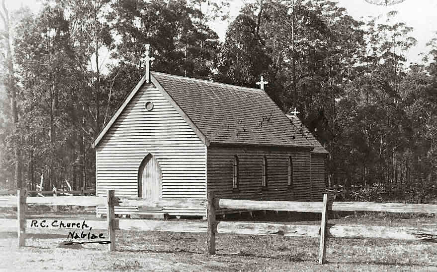
Photograph of St Isidore’s Catholic Church.
Courtesy of the late Les Weller’s collection.
Presbyterian Church services were held at Glen Ora (the home of the McKinnons) for many years and a church was built in Krambach in 1900.
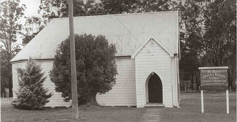
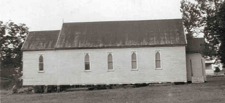
Photograph of St Paul’s Anglican Church.
Courtesy of Trevor Mavin.
St John’s Anglican Church in Dyers Crossing dates from 28 October 1939 when the foundation stone was laid by Bishop Batty.
Photograph of the Methodist Church.
Courtesy of the late Les Weller’s collection.
In 1933 a Baptist Church was dedicated in Minimbah but following declining attendances, it was closed and subsequently demolished.
Shops and Businesses
In the earliest times on the river, the nearest shops were at Tinonee and settlers made the long journey there for necessities such as drapery, clothing and food.
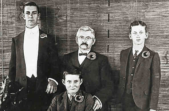
The caption at the bottom of this photograph reads:
The Members of the Firm Albert Von Ehlefeldt & Sons, Forster and Sydney. The only Great Northern Universal Providers.
Albert Snr. is standing in the centre with his sons (L to R) George, Albert Jnr. and Amandus.
Courtesy of the late Les Weller’s collection.
The position was somewhat improved when Albert von Ehlefeldt (shown) began running his dealer’s boat up the river, heralding his arrival by means of a bullock horn. Albert and family lived in the watershed and sent business postcards with his families photograph on it (taken in 1921) to his customers. The one shown in this instance was to Henry Weller who lived on the Wallamba River upstream from Nabiac. Hugh Breckenridge also had a store boat on the river.
Businesses did slowly arrive in Nabiac and one of the first was the store/post office erected by James and Jane Bowers.
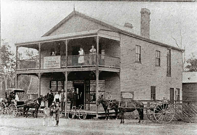
Photograph of The Red Store.
Courtesy of Trevor Mavin.
John Breckenridge‘s Burnside Store (in the 1880s) which stood, with the Burnside Hall, where the National Motorcycle Museum now stands;
Charles Wooster‘s store (1880s also);
The Failford Store was built and operated in the early 1880s in the centre of that village;
Edwin E Gorton set up a saddlery and boot-making store in 1894 and employed quite a number of men – including his wife who was skilled in doing the lighter finishing work on the leather goods. At one time the business employed three generations of the family; and
Frederick Phillips built “The Red Store” (photograph on the left) in 1903 at the intersection of Nabiac and Donaldson Streets above the Bullock Wharf. It faced south and its name derived from the colour it had been painted.
Blacksmiths were most important to the community in early times and Nabiac did boast having four, Avalon, Coolongolook and Krambach had one each and several men were attached to the large mill in Failford.

Photograph of the motorised butcher’s cart.
Courtesy of the late Les Weller’s collection.
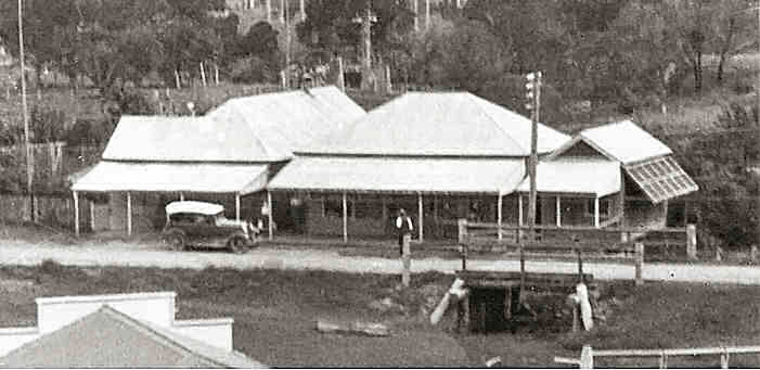
Photograph of Nabiac’s shops.
Courtesy of the late Les Weller’s collection.

Photograph of the directors and staff of the dairy factory, taken in 1908.
Courtesy of the late Les Weller’s collection.
Sadly, there are few dairy farms in the district now many having been converted to the raising of beef cattle or sub-divided to become hobby farms.
No settlement however, was thought to be complete without a hotel and Nabiac was no different. Henry and Annie Beisler arrived in Australia from Germany around the middle of the 19th century and he found work cutting timber and splitting shingles around Wang Wauk. One day when riding to Tinonee (for supplies?) he saw an outcrop of red soil just north of Nabiac and thinking this would be suitable soil for a vineyard, he took up the land in 1879. Over two hundred grape vines were planted and in 1882 the Beisler‘s took out a wine licence, opened a shop and a hotel licence was obtained later. On the first edition map of Nabiac (published in 1887) the “Fern Hill Hotel” is shown on the ridge just north of Pipeclay Creek Lane.
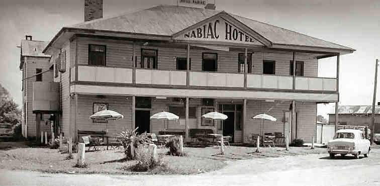
Photograph of the Nabiac Hotel.
Courtesy of Trevor Mavin.
Recreational, Cultural and Other Amenities
Social functions and church services were held for many years in the Burnside Hall but funds were raised by means of small functions and the School of Arts was erected beside the Police Station in 1896. This hall then became the focus of a wide range of social activities in the village such as concerts, dances, wedding receptions and it also contained a library which, given the number of books it purchased, must have been well patronised. Both Krambach and Dyer’s Crossing also built similar halls.
Nabiac’s first race course was at Fern Hill near the Beisler‘s hotel and it appears it operated between 1883 and 1900 when the general sportsground was moved to Gleeson’s Flat on the north side of Wallanbah Road and the Nabiac side of Candoormakh Creek. Here cycle, foot and horse races were held as well as cricket, football and tennis matches. One of the most famous football matches played here was in 1911 when the village hosted a visit by the Newtown Rugby team. Village history relates they stayed in the Nabiac Hotel and were feted well into the night – while the Nabiac side was home in bed. And did the Newtown side win the match the next day? No way, the Nabiac village side flogged them! Krambach also boasted a race course below the village on Paterson’s Flat. In the 1950s another race course – “Murray Park” – was built at Nabiac on the left of Wallanbah Road a kilometre beyond Dargaville’s Road.
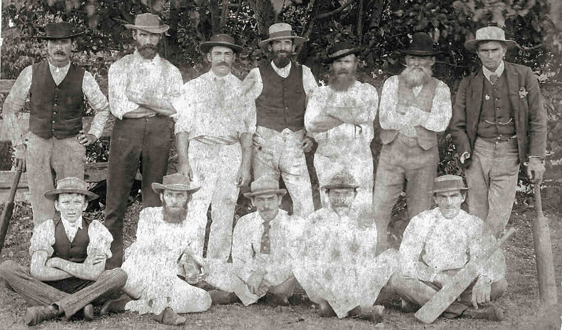
Photograph of The Pearls cricket team.
Photograph of The Pearls cricket team.
The players in the photograph were: (Back row L to R) Bob Reeves, C. Dargaville, H. Wallis, G. Harris, J. Warr, G. Wallis and Jessie Wallis. (Front row L to R) J. Gorton, H. G. Weller, J. R. Weller, W. Wallis and Fred Wallis.
Courtesy of the late Les Weller’s collection.
Cricket was played around the area regularly from an early date with many local teams being formed. The team shown is The Pearls cricket team and their home field was on Croker farm some 5 km above Nabiac on the Wallamba River.
On 30 November 1886 an area adjacent to the Nabiac School playground was notified as a “Recreation Reserve” but the surveyor did note it was low, wet land (with) tea trees and gum.
Much soil however, was moved by volunteers from the top side of Clarkson Street to greatly improve the field’s surface. This field was used for cricket, football and was the venue on which travelling circuses pitched their tents. The town tennis courts were also built at that site in 1922.
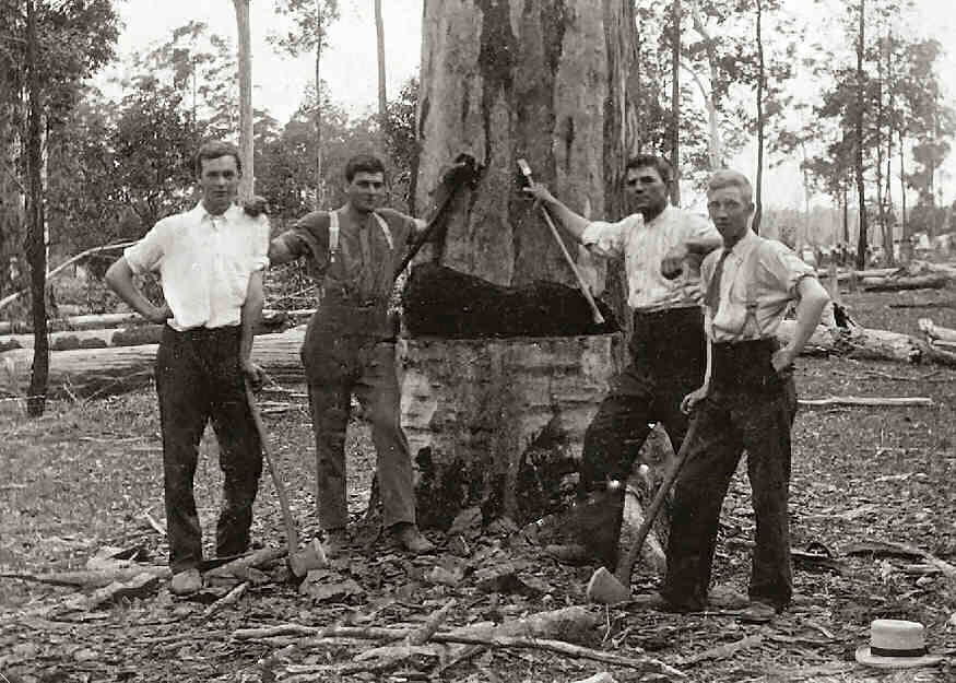
Photograph of tree loppers (L to R) H. Croker, W. Munro, J. Lulham and Claude Wright posing in front of a tree they’re in the process of falling.
Courtesy of the late Les Weller’s collection.
“Magic Lantern” shows were held at the School Arts for many years but in 1937 the first 35 mm movies were shown in the Showground Hall. The Showground Hall is still the main activity venue in the village.
In 1928 Dave Hancock installed a 110 volt DC electricity generating plant in the rear of his shop and supplied not only him, but several other businesses with electricity. Following an accident that almost cost him his eyesight however, he sold the plant to Herman Everingham. Les Weller purchased the plant in 1934 and continued to supply the village with electricity until the early 1950s.
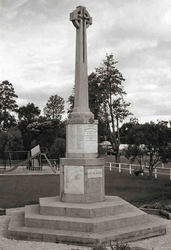
Photograph of the Wallamba District War Memorial.